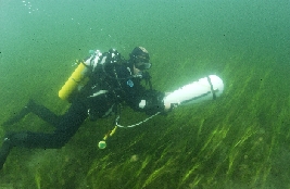
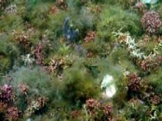
Between 2005 and 2010 surveys of sensitive biological communities (e.g. seagrass, maërl, etc) were undertaken. Previous reports were reviewed to focus the efforts of a team of surveyors who undertook intensive dive transect sampling to map community distribution, extent and biological composition.
Between 2009 and 2012, an intensive national programme of work to carry out benthic surveys of approximately 100 marine Natura 2000 sites commenced in partnership with the Marine Institute. These surveys mapped the distribution and extent of intertidal and subtidal, benthic communities based on analysis of physical and biological data.
In addition in 2012, NPWS commissioned a survey of the Codling Bank to investigate the composition of this area of the Irish Sea.
 |
 |
| Photo: Diver surveying underwater seagrass beds | Photo: Clew Bay Maërl Bed |
